Thirteen Villages & One Goal... West Newton
West Newton is one of Newton’s most historic, economically diverse and conveniently located villages. Its village center, West Newton Square, has many attractions to draw visitors, despite the rundown appearance of its sidewalks and other public fixtures, and the dwindling number and deteriorating condition of its trees.
|
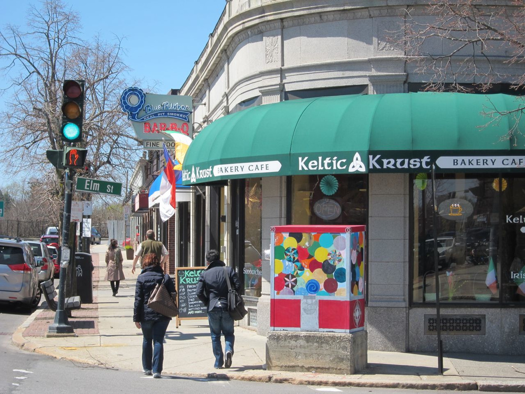
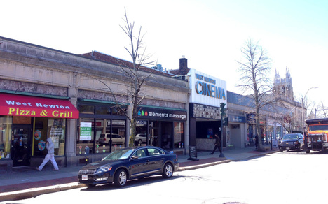
Although the village of West Newton was divided by the construction of the Mass Pike, all of West Newton Square’s commercial area is located on the north side, giving it a more cohesive feeling than Newtonville or Newton Corner. Visitors are drawn to the West Newton Cinema and the Square’s numerous and varied restaurants.
Foodies' Delight in West Newton Square. Photo, NVA.
|
West Newton Cinema and village square. Photo, NVA.
Wherever you choose to eat, two bicycle stores and a gym will help you stay fit. West Newton is also home to Newton Police headquarters, Newton District Court, and the National Guard Armory. A block north of the Square is the West Newton Community Services Center, in the former Davis School. Not far from West Newton Square to the east are Trader Joe’s and The Barn, a popular family-owned and operated shoe store for over 60 years.
|
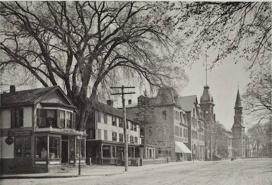
Washington St., West Newton, 19th c., Source, Newton Library.
Throughout the 1800s, West Newton became known as a center of education, with innovative educators Seth Davis, Horace Mann, Cyrus Pierce and Nathaniel Allen all living and working in West Newton. The landmark Nathaniel Allen House, turned into a girls’ school after his death, was recently acquired by the Newton Cultural Alliance and is being renovated as a music school and cultural center, with the help of Community Preservation Act funds.
|
West Newton was first settled in the mid-1600s. In the mid-1700s, descendants of those families broke from the congregation in Newton Centre to form the West Parish. The West Parish Burying Ground, one of Newton’s three historic burying grounds, is located at River and Cherry Streets. The village began to grow significantly when the Boston & Worcester Railroad line reached West Newton in 1834.
Nathaniel Allen House. Photo, NVA.
|
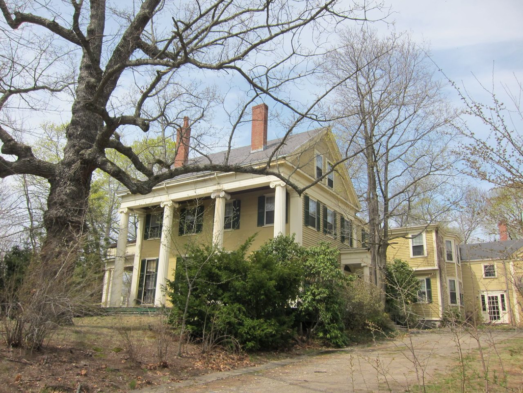
Historic Victorians on Putnam Street, West Newton Hill, circa 1880s-1890s. Photo, NVA.
|
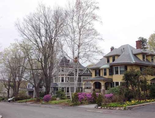
West Newton, north of Washington Street and the Mass Pike, has historically been one of the more affordable parts of Newton, while West Newton Hill, south of the village center, in the post-Civil War period became home to wealthy manufacturers and businessmen who built large (for the time) mansions in architectural styles including Italianate, Stick, and Queen Anne
North of Washington Street, from Cherry Street west, became homes for working people, including many Irish immigrants in the 1800s, and Italian immigrants after World War I. |
|
The Myrtle Baptist Church-Curve Street area developed as an African-American neighborhood after the Civil War, with residents attracted by the church, jobs, the city’s abolitionist history and West Newton’s liberal culture.
Half of the Myrtle Street neighborhood was destroyed by the construction of the Mass Turnpike Extension in 1963; the remaining portion is now listed in the National Register of Historic Places. A new, small-scale 40B affordable housing project called Myrtle Village was built on land near the historic church. |
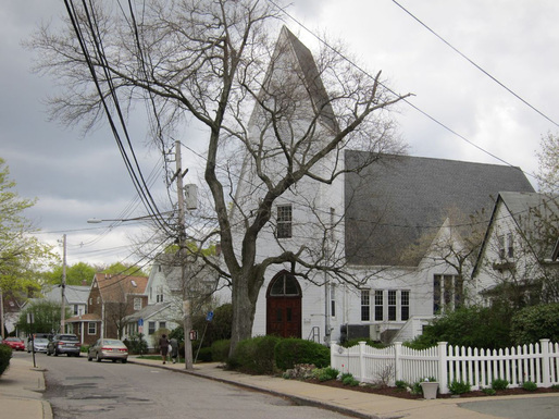
Myrtle Baptist Church. Photo, NVA.
|
Randlett Park colonials, built in 1920s-1930s. Photo, NVA.
In 1999, already concerned about the potential for overdevelopment of their neighborhood of mostly single-family Capes into large duplex condos, and loss of open space, an overwhelming majority of residents of the area bounded by Webster Street, Murray Road, Auburndale Ave, and the Dolan Pond Conservation Area petitioned to have their properties rezoned from MR1 to SR3.
|
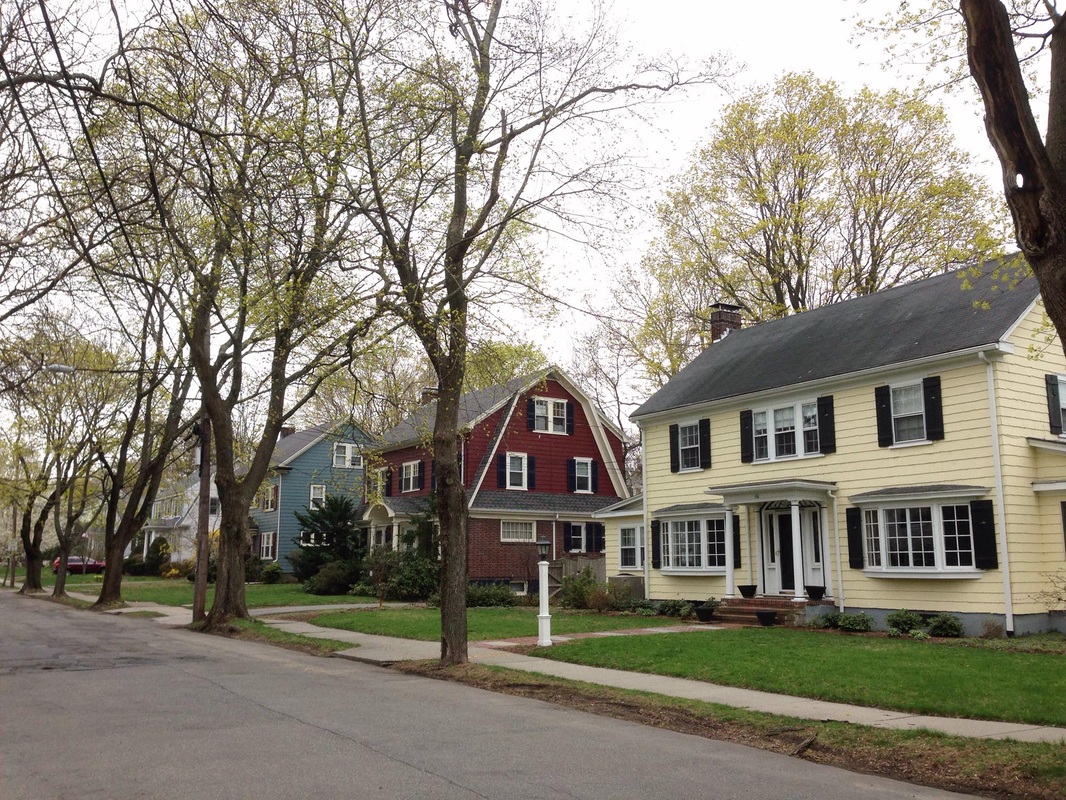
Much of the northeast section of West Newton, from the Waltham Street area east, was developed later, as open fields and former estates were divided in the early 1900s. Many houses here are well-built Colonials constructed in the 1920s and ‘30s. 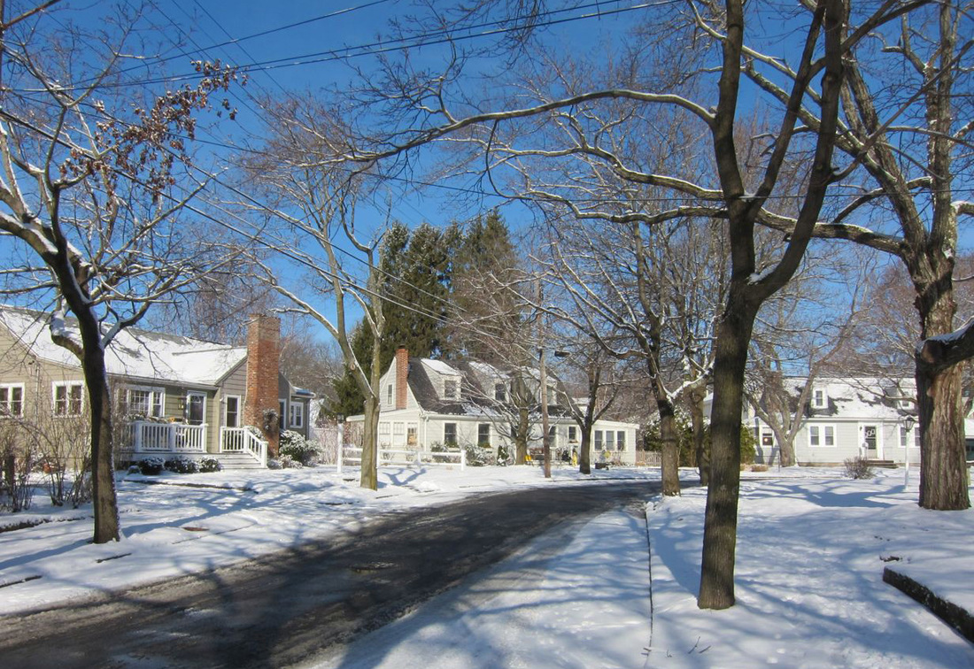
Stratford Road Capes, built 1938-1940, part of area re-zoned in 1999 from MR1 to SR3. Photo, NVA.
|
This "downzoning" was approved by the Board of Aldermen in 2000.
Over-Development and Density Challenges Facing West Newton Include:
- Developer Robert Korff has purchased many properties in West Newton and has proposed a 40B at the site of the Barn shoe
store and projects that will densify and urbanize West Newton Square and Washington Street.
- Loss of smaller, more affordable homes and surrounding trees and greenspace to teardowns
- Increasing density and land loss of private open space due to multi-unit housing developments in the areas around the
West Newton Playground along Oak Street, Elm Street, Cherry Street, Webster Street, and in Webster Park
- Increased traffic related to the toll-free Mass Pike interchange, and development
Losing Smaller, Affordable Houses & Their Green Space to McMansions
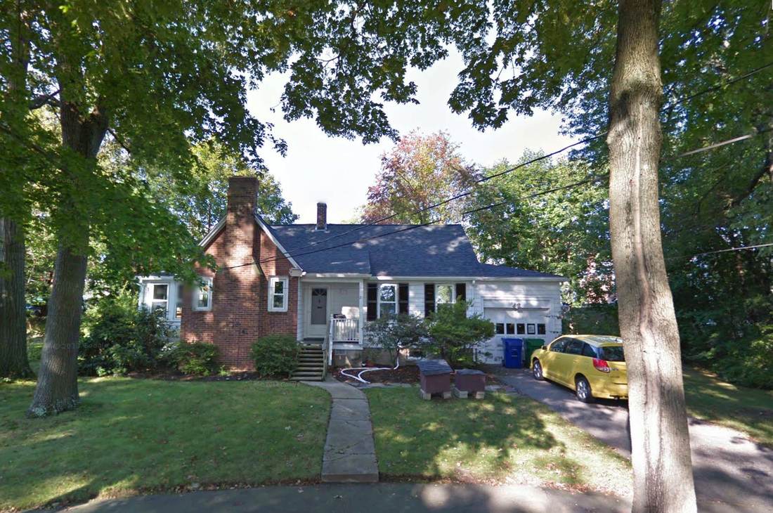
21 Parmenter Terrace before teardown. Photo, Google.
|
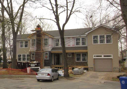
21 Parmenter Terrace after teardown. Photo, NVA.
|
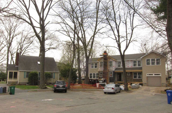
Building huge houses on lots meant for small ones crowds and changes established neighborhoods. Photo, NVA.
|
Smaller, affordable houses are being lost to demolitions and McMansions in every village of Newton, and West Newton is no exception.
These compact houses are owned by singles, moderate income families, and empty-nesters able to "age in place" because their houses are not overwhelmingly large. They would be appealing to downsizing seniors, or to young families hoping to raise their children in Newton, but they are vanishing, as developers outbid other buyers. |
As long as FAR regulations permit the construction of much larger replacement houses, developers will view such properties as buildable lots and will, in most cases, seek to maximize profits by buildimg the largest house permitted. In the process, they will eliminate green space, and much of the housing stock that has made West Newton more diverse in income and occupation than other parts of Newton.
Losing Historic Houses to Higher Density, Multi-Unit Housing Projects
In the neighborhood near the West Newton Playground, along Oak Street, Elm Street, Cherry Street, Webster Street, and in historic Webster Park, older, charming houses are being demolished to make way for multi-unit housing developments with few trees, little green space and more garage doors than character. West Newton's history and architectural heritage are being obliterated.
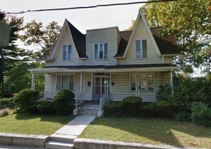
Demolition delay on this Webster Park historic Gothic Revival cottage. Photo, NVA.
|
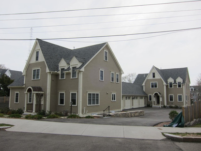
New Multi-Unit Housing on Elm Street. Photo, NVA.
|
Mass Pike Interchange-Related & Development-Related Traffic Congestion
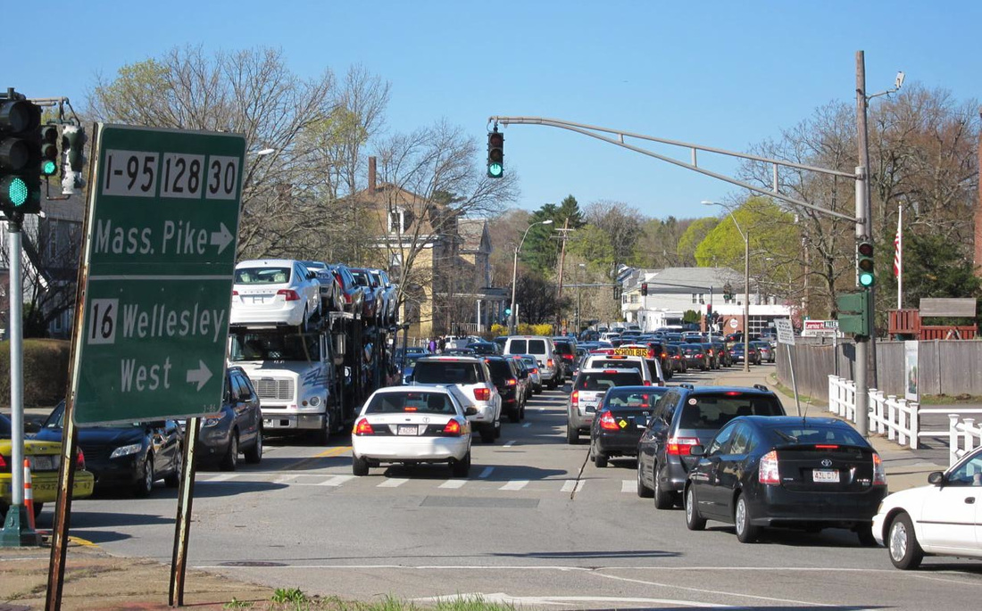
Mass Pike effects. Photo, NVA.
|
The Massachusetts Turnpike is a boon to the region, but a mixed blessing to the four Newton villages sliced in half by it. West Newton is fortunate that its village center sits on one side of the Turnpike, but the nearby interchange between the Turnpike and Route 128 creates extended rush-hour traffic congestion on nearby West Newton roads, most notably Washington and Auburn Streets, as drivers avoid the Route 128 tolls. New housing units in the Oak-Elm-Cherry-Webster and Auburn Street neighborhoods also contribute to additional car trips. |