Thirteen Villages & One Goal... Newton Lower Falls
The village of Newton Lower Falls developed along a stretch of the Charles River where the river drops, in a series of beautiful waterfalls, a dramatic 18 feet in only a quarter of a mile. It's a place of great natural beauty, as visitors to the restored Lower Falls Rail Bridge nearby can attest. Although Lower Falls does not include a locally-designated historic district, since 1986, much of the village has been listed as an historic district on the National Register of Historic Places.
|
According to state documents offered in support of that national designation, a Native American path once traversed the village, roughly where Washington Street is now. During the 17th century English colonists operated gristmills and sawmills at the lower falls. In the early 18th century, an ironworks was established, and the village began to grow.
Lower Falls, looking south to Washington St., 19th c.
|
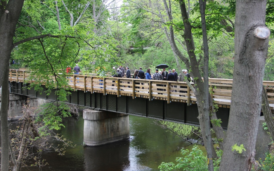
Lower Falls Rail Bridge restored for pedestrians. Photo, Newton Conservators.
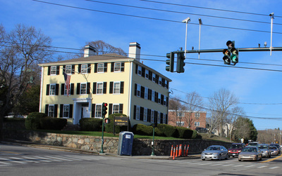
It is wonderful that so many of Lower Falls' historic buildings are still in use. The building visible on the left side of the photo at left is still a working commercial building today. Built in 1840, and owned by the same family since the late 1800's, Boyden Hall houses the Lower Falls Wine Company, pictured at top.
|
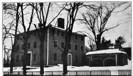
The Baury House in 1919.
|
The Baury House today.
|
The Baury House is another immediately recognizable structure in Lower Falls. Built in 1755, it is the oldest house in Lower Falls, though now used for offices. At the corner of Washington and Concord Streets, it stands like a sentinal marking the entrance to the village. The Baury House and Boyden Hall are both visible on an 1880 map of the village (below, left). Boyden Hall is near the top of the map (the orientation is south at the top), the large building southeast of the Washington Street bridge. The Baury House is diagonally across from it, going northeast, at the intersection of Washington and Concord Streets. Both are visible in the aerial photo (below, right), though the mills lining the river on the 1880 map are long gone.
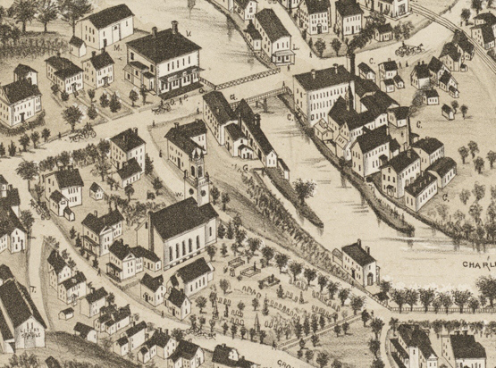
Map of Newton Lower Falls in 1880.
|

Aerial photo of Newton Lower Falls today. Photo, Bing.
|
If one were standing on the Washington Street bridge in the the 19th century, looking northwest from the bridge to the opposite riverbank, the view would have been that of the photo (below, left). The mill and smokestack in the photo are also visible in the 1880 map above. A little bit north, along Concord Street was St. Mary's Episcopal Church, overlooking the river. St. Mary's is clearly visible in the 1880 map above, and is pictured (below, right) in an undated photograph and today.
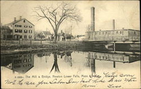
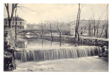
View from Washington St. Bridge of a Mill at Lower Falls.
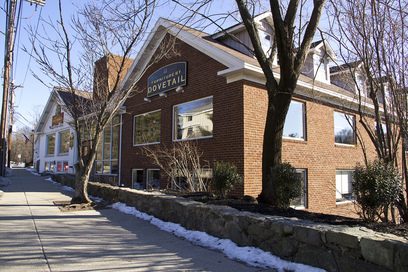
Commercial buildings with sympathetic scale and architecture preserve village character.
|
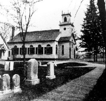
St. Mary's Church. Photo, K. Newcomb, Makers of the Mold.
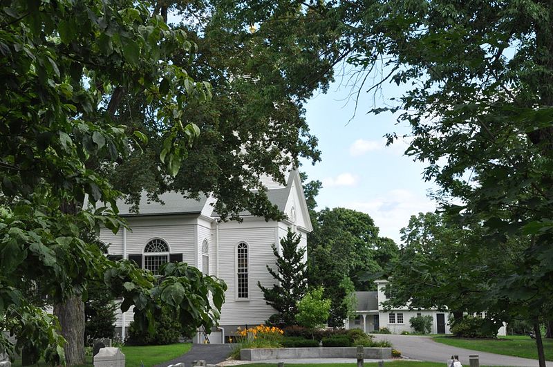
St. Mary's Church today. Photo, CC.
|
|
In the 1830s and 1840s, a number of Greek Revival houses were built near St. Mary's Church. Lower Falls also has a considerable stock of millworker cottages and other houses of historical and architectural interest. A fire station (built in 1900) and the the Lower Falls Community Center at the former Hamilton School are other landmarks in the village.
Many of the historic grand houses of the mill owners and the cottages of the millworkers were demolished in the 20th century, in some cases as part of the construction of Route 128, beginning in the late 1920s. What remains of Lower Falls is a beautiful, mostly intact, small mill village. It is something all in Newton can be proud of, and wish to preserve for future generations. |
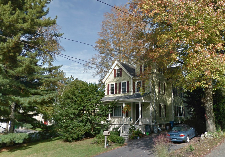
A typical Lower Falls house. Photo, Google.
|
Challenges Facing Lower Falls
Riverside
The Riverside Development Project is a mixed-use transit-oriented development on a portion of the Riverside MBTA parcel. The MBTA will maintain ownership of the land, but hundreds of apartments and a large commercial development are proposed for the site, threatening to bring tremendous traffic to the area, and costs to taxpayers in the form of school overcrowding and costs, plus the increased costs of providing additional city services and staff to additional households.
The Riverside Development Project is a mixed-use transit-oriented development on a portion of the Riverside MBTA parcel. The MBTA will maintain ownership of the land, but hundreds of apartments and a large commercial development are proposed for the site, threatening to bring tremendous traffic to the area, and costs to taxpayers in the form of school overcrowding and costs, plus the increased costs of providing additional city services and staff to additional households.
|
Geography & Development Pressures
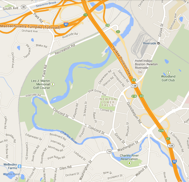
Newton Lower Falls is bounded by the Charles River on three sides and Route 128 to the east. Almost one third of the village is open space, part of a state-owned golf course and cross-country skiing facility. What remains is a tight-knit and very small community - a genuine village. It is a village under the same development pressures as elsewhere in Newton, but here the pressures are magnified by the small land area of Lower Falls. If the cycle of teardowns followed by construction of McMansions or high-density multi-unit housing plays out in Lower Falls, it will be a terrible loss in terms of Newton's history and in terms of preserving affordable single-family houses for Newton families. |